In this article
- Is the Maja e Dhoksit hike right for you?
- Liqeni i Zi Bulqiza, the Dhoksi lakes and the Mali i Lopes hike question
- Planning the route from Klos: road access, start points and navigation
- What you see on the trail: Liqeni i Zi, ridges and Bulqiza views
- Safety, weather and gear for Bulqiza hiking
- Best season and where to stay before or after the hike
- Frequently asked questions
Is the Maja e Dhoksit hike right for you?
The Maja e Dhoksit hike is not a soft lakeside stroll. It is a serious mountain day for confident walkers who are ready for rough ground, changing weather and a descent that still needs attention after the best views have been taken in.
From our home in Klos, the day begins before the valley is fully awake. The air is still, the road is quiet, and the mountains toward Bulqiza look close enough to touch. That calm can be misleading. Once you leave the last roads and move toward Liqeni i Zi Bulqiza and the Dhoksi lakes, you are in high country where preparation matters more than a perfect photograph.
This route suits hikers who already know how a long mountain day feels. You should be comfortable with steep sections, faint or broken paths, loose ground and navigation that may not always match what you expect from a marked European trail. A car is helpful for the approach, but the drive is only the first part of the day. The real work begins when the road ends.
Difficulty in plain English
Treat this as an advanced hike. Not technical climbing, in normal dry summer conditions, but still demanding. The challenge comes from the mix: altitude, route-finding, exposed viewpoints, possible weather changes, and limited services once you are committed to the high section.
If you need clear signposts every few minutes, cafes along the way, or an easy place to stop and call a taxi, this is not the right plan. If you are used to reading terrain, saving battery, carrying layers and turning around when the mountain gives a warning, then the Maja e Dhoksit area can reward you with one of the quieter high-lake days in Dibër.
Photographers often love this route because it gives dark water, pale rock, ridgelines and wide views toward Bulqiza. Bring the camera. Just do not let the camera decide the schedule. A late descent on rough ground is never worth one extra frame.
Who should skip it
Casual walkers, families looking for an easy picnic by water, and visitors without navigation confidence should choose a lower walk or a guided village route instead. There is no shame in that. Good mountain judgment begins before the boots are tied.
If the forecast is uncertain, if there has been heavy rain, or if you are unsure about the road approach, ask locally before committing. Conditions in the mountains change faster than plans made on a phone screen.
Liqeni i Zi Bulqiza, the Dhoksi lakes and the Mali i Lopes hike question
Bulqiza sits in Dibër County, east of the Mat region, in mountain terrain that feels different from the softer hills around many Albanian villages. The roads bring you toward the high country, but they do not turn the hike into an easy roadside attraction.
Liqeni i Zi means Black Lake. Around it, hikers often speak about the Dhoksi lakes, a group of high mountain waters and tarns reached depending on the exact route chosen, snow conditions and local access. We avoid promising one fixed lake count or one official line, because mountain routes here are shaped by weather, roads, livestock paths and the judgment of the people walking that day.
You may also see this area connected with searches for a Mali i Lopes hike. Local naming can vary, and visitors sometimes use the wider Mali i Lopës highlands to describe the mountain area around these routes. The safe way to plan is not by chasing a name alone, but by checking the actual start point, route condition and weather window for the day you intend to walk.
For travelers staying with us in Klos, this is best understood as a drive-plus-hike day. You are not stepping out after breakfast for a quick lake stroll. You are building a full mountain plan: early departure, careful driving, steady ascent, time at the lake or lakes, and a descent with daylight left in hand.
Why this area feels wilder than the name suggests
Some Albanian mountain places sound simple when listed on a map: lake, peak, village, road. On the ground, the feeling changes. Above Bulqiza, you can move quickly from inhabited areas and work roads into slopes where services are limited, signs are not guaranteed, and rescue access is not something to take lightly.
That is part of the appeal for strong hikers. It is quieter than many famous routes. It feels open. The wind has room. But this same quietness means you need to carry what you need and make decisions early.
How it differs from easier lake hikes
Many lake walks are about arrival: drive close, walk a little, sit by the water. This is different. The water is a highlight, but the route asks for stronger legs and more attention. If you want another Dibër mountain lakes day with a different rhythm, the Balgjaj Lakes area may also belong on your list, but Maja e Dhoksit and Liqeni i Zi feel more committing and route-dependent.
Planning the route from Klos: road access, start points and navigation
There is no single trailhead we can honestly name for every visitor and every season. Road condition, parking, weather damage and local access can shift. Before you go, confirm the current approach with people who know the area, especially if you are driving a low car or visiting after rain.
Bujtina Çupa is in Fshat, on Rruga e Arbërit, near Klos in Dibër County. The modern road has made our part of the Mat and Dibër region easier to reach from Tirana, with the drive now about 35–40 minutes via Rruga e Arbërit after the Murriz Tunnel opened in March 2025. That helps with regional travel, but it does not make the final mountain roads fast or simple.
Leave early. Download your route before departure. Save an offline map and a recent GPX track if you are walking independently. Mobile signal can drop in the high valleys, and a blue dot on a screen is not enough if the path fades or cloud lowers onto the slope.
Ask us about our hiking experiences before you choose the route.
Our listed Hiking Rruga e Arbërit experience is a guided full-day mountain outing with historic route, viewpoints and packed lunch. Maja e Dhoksit is a separate advanced objective, but guests planning demanding hikes can still ask us about local conditions, guidance and whether the day looks sensible.
Guide, GPX or both?
A strong independent hiker can use a recent GPX, offline mapping and careful route judgment. That does not mean every track online is safe on the day you arrive. A GPS line may have been recorded in dry weather, by someone moving faster than your group, or before a road washout changed the approach.
A local guide is wiser after storms, in shoulder season, when visibility is uncertain, or when nobody in your group has walked in Albanian high mountain terrain before. The guide does not remove the effort. The guide helps remove the guessing.
A realistic day plan
A good day starts with breakfast, water bottles filled, batteries charged and no rushing. Our restaurant breakfast is served from 07:30 to 09:30, but for a demanding mountain plan you should speak with us in advance so the morning is practical.
From Klos, drive toward the Bulqiza side, confirm the road and start point, climb steadily, take your main rest near Liqeni i Zi or the Dhoksi lakes if conditions allow, then begin the descent while you still feel strong. Plan it as a full day, not as an afternoon extra after other sightseeing.
What you see on the trail: Liqeni i Zi, ridges and Bulqiza views
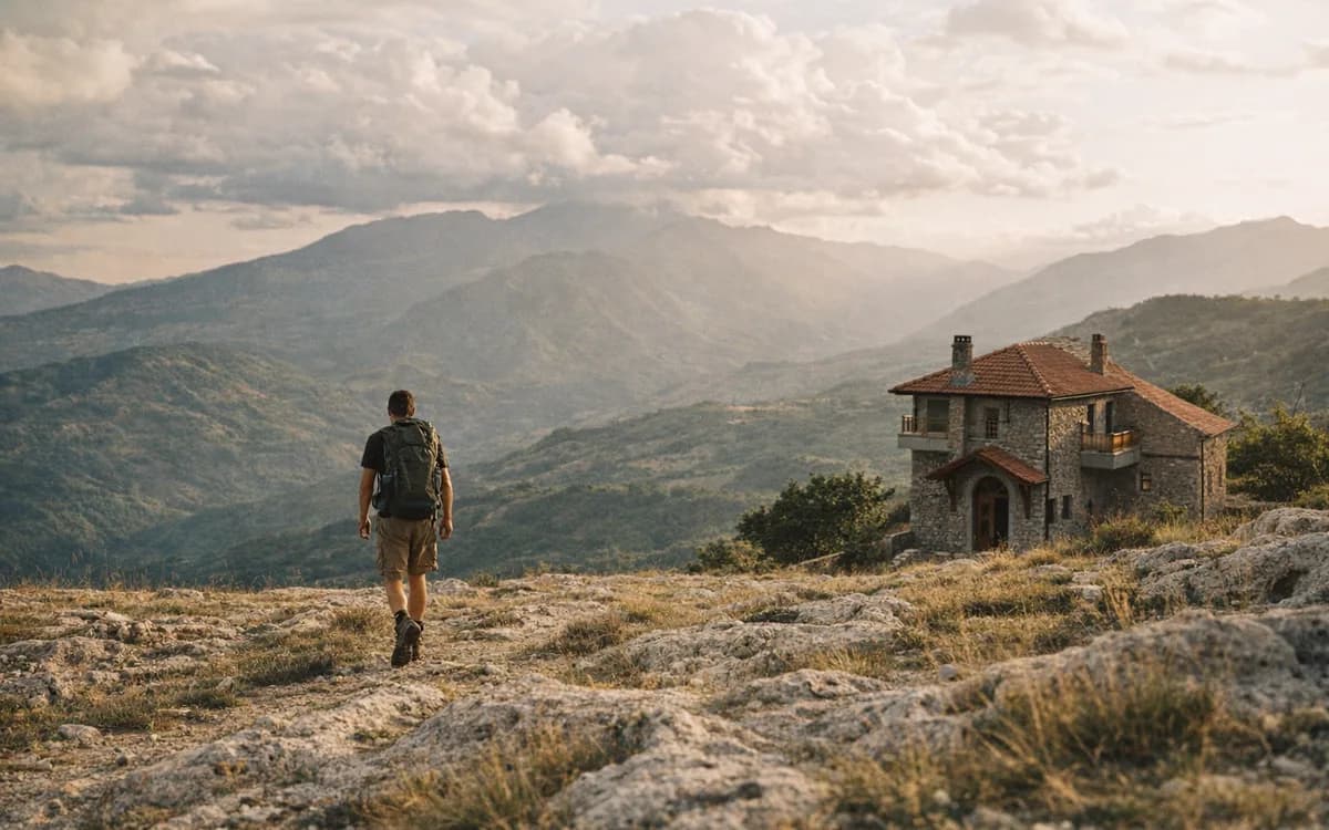
The visual rhythm of the route is simple but powerful. First comes the approach: road edges, rough ground, slopes opening above the villages. Then the mountain widens. Grass, stone and sky begin to dominate, and the lake appears darker than expected when the light is flat.
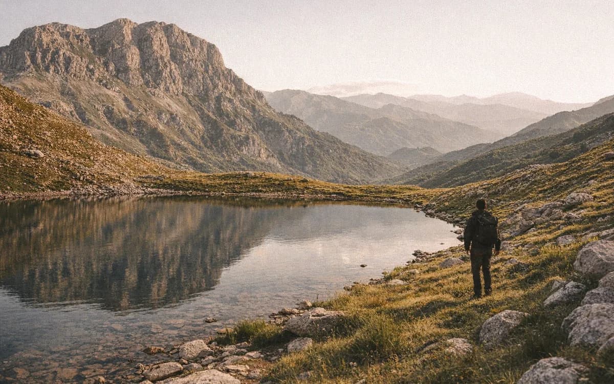
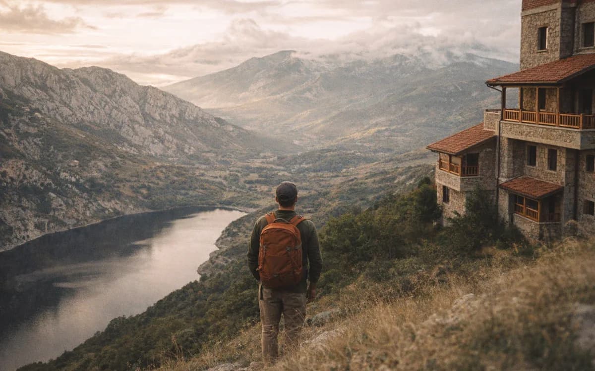
At Liqeni i Zi Bulqiza, the water can look almost black under cloud and deep blue when sun breaks across it. If your chosen line continues toward other Dhoksi lakes or higher shoulders, the views become broader. Bulqiza sits below, with its mountain-town shape and working landscape, while the ridges pull the eye toward the wider Dibër highlands.
The best photographs are often not taken from the lake edge itself. A safe point slightly above the water can show the shape of the basin, the color of the lake and the line of the ridge in one frame. But safety decides where you stand. Wet grass, loose rock and lake edges deserve respect.
Photo stops that do not cost the descent
Choose three main pauses: one at the lake, one on a safe shoulder of the ridge, and one looking back during the return. This is better than stopping every few minutes and slowly losing the daylight buffer you worked so hard to create.
If you carry a polarizer, it can help with glare on the water. Protect your camera from sudden rain or cloud moisture. Keep drone use respectful: check rules, avoid people and livestock, and do not fly where wind or visibility makes it unsafe.
What not to expect
Do not expect cafes, a tourist promenade, guaranteed signs or an easy bailout from the high section. This is not a managed lake park. It is a mountain route where you bring your own food, water, clothing and decisions.
That honesty matters. The route is beautiful because it still feels raw in places, but raw ground asks for more from the people who cross it.
Safety, weather and gear for Bulqiza hiking
Good Bulqiza hiking starts with humble planning. Summer and early autumn are usually the best window for high mountain-lake routes, with longer daylight and more reliable access. Even then, strong sun, afternoon storms, sudden wind and cold cloud can arrive faster than visitors expect.
Avoid the Maja e Dhoksit hike in fog, heavy rain, high wind, lingering snow, thunder risk or if the road approach has been damaged. A route that feels direct in clear weather can become confusing when the ridge disappears into cloud.
Tell someone your plan. Start early. Keep a turnaround time. Carry enough water and food for longer than you expect. A small delay, a twisted ankle, or a wrong line across rough ground becomes more serious when services are far away.
Minimum gear checklist
- Navigation - offline map, recent GPX, phone fully charged, and a battery bank.
- Footwear - proper hiking boots or strong trail shoes with grip, not city trainers.
- Clothing - breathable layers, warm layer, waterproof shell, hat and sun protection.
- Food and water - more than you think you need, especially in hot weather.
- Safety kit - first-aid basics, headlamp, whistle, emergency blanket and any personal medicine.
- Communication - share your plan before leaving, because signal may not stay with you.
Watch lake edges and loose slopes. Give livestock and dogs space. If a track becomes unclear, stop early and solve the problem while everyone is calm, not after the group is tired.
When to turn back
Turn back if cloud drops onto the ridge, thunder builds, the group is moving too slowly, someone is injured, the route no longer makes sense, or you reach the lake later than planned. Turning back is not failure. It is the decision that lets you walk again tomorrow.
This is especially true in places with limited services. In remote terrain, small mistakes grow quickly. Pride is poor equipment.
Best season and where to stay before or after the hike
For most visitors, summer to early autumn is the normal planning window for the Maja e Dhoksit area. Late spring can still hold snow in shaded or high places. Late autumn brings shorter days, colder wind and less room for delays.
Klos works well as a base because you can rest before the effort instead of driving long hours tired. Our guesthouse has 9 rooms, each with a private bathroom, air conditioning, mountain view and free high-speed WiFi. Room types include the Deluxe Double Room, Triple Room, Deluxe Triple Room and Family Room, with direct booking giving 10% off compared with OTA bookings.
Rest before the early start in our rooms in Klos.
Dinner after a hard mountain day should be simple and warm. Our evening service runs from 18:00 to 22:00, and hikers often want exactly what the kitchen does best: village food, bread from the wood-fired oven, and slow dishes. If you want something traditional, ask about Pule fshati me jufka, Tavë dheu, or a shared Sofër tradicionale e madhe when you are back down and hungry.
Maja e Dhoksit or the Balgjaj Lakes?
Choose Maja e Dhoksit and Liqeni i Zi if you want a more committing day, stronger route-finding and a high viewpoint over Bulqiza. Choose the Balgjaj Lakes area if your plan is another mountain-lake day in the region with a different approach and rhythm.
Neither should be treated casually without checking conditions. The difference is the level of commitment, not whether the water is worth seeing. Both belong to the wider story of Dibër mountain lakes, where the best days come from early starts and patient decisions.
After the descent
Do not plan a long night drive immediately after the hike if you can avoid it. Clean clothes, warm food and an unhurried evening are part of the safety plan too. Tired drivers make poor decisions, and tired hikers deserve a quiet table.
Planning a serious mountain day and a quiet place to sleep after it? Book your stay with us in Klos.
Frequently asked questions
How difficult is the Maja e Dhoksit hike?
The Maja e Dhoksit hike is an advanced mountain route with steep ground, rough paths and limited services. It suits experienced hikers with navigation skills and good weather judgment.
Can you hike to Liqeni i Zi Bulqiza without a guide?
Experienced hikers can use a recent GPX and offline map, but a local guide is safer when visibility, road access or trail conditions are uncertain. A GPS track is useful, but it does not prove the route is safe that day.
What is the best season for the Dhoksi lakes hike?
Summer and early autumn are the best seasons for most hikers. Late spring can hold snow, while late autumn brings shorter days and colder mountain weather.
Is Maja e Dhoksit a day trip from Klos?
Yes, it can be planned as a full-day drive-and-hike from Klos. Start early, keep daylight for the descent and avoid treating it as a quick afternoon outing.
Is Liqeni i Zi Bulqiza suitable for casual walkers?
No. Liqeni i Zi Bulqiza is better treated as part of a serious mountain hike, not as an easy lakeside walk for casual visitors.